![Item #5475 [Map] CARTE ADMINISTRATIVE, PHYSIQUE, ET ROUTIERE DE LA FRANCE. | association Dufour, Francis Peyre Porcher, Auguste Henri.](https://michaelpyron.cdn.bibliopolis.com/pictures/5475.jpg?width=768&height=1000&fit=bounds&auto=webp&v=1633632924)
![[Map] CARTE ADMINISTRATIVE, PHYSIQUE, ET ROUTIERE DE LA FRANCE](https://michaelpyron.cdn.bibliopolis.com/pictures/5475_1.jpg?auto=webp&v=1633632924)
![[Map] CARTE ADMINISTRATIVE, PHYSIQUE, ET ROUTIERE DE LA FRANCE](https://michaelpyron.cdn.bibliopolis.com/pictures/5475_2.jpg?auto=webp&v=1633632924)
![[Map] CARTE ADMINISTRATIVE, PHYSIQUE, ET ROUTIERE DE LA FRANCE](https://michaelpyron.cdn.bibliopolis.com/pictures/5475_3.jpg?auto=webp&v=1633632924)
![[Map] CARTE ADMINISTRATIVE, PHYSIQUE, ET ROUTIERE DE LA FRANCE](https://michaelpyron.cdn.bibliopolis.com/pictures/5475_4.jpg?auto=webp&v=1633632924)
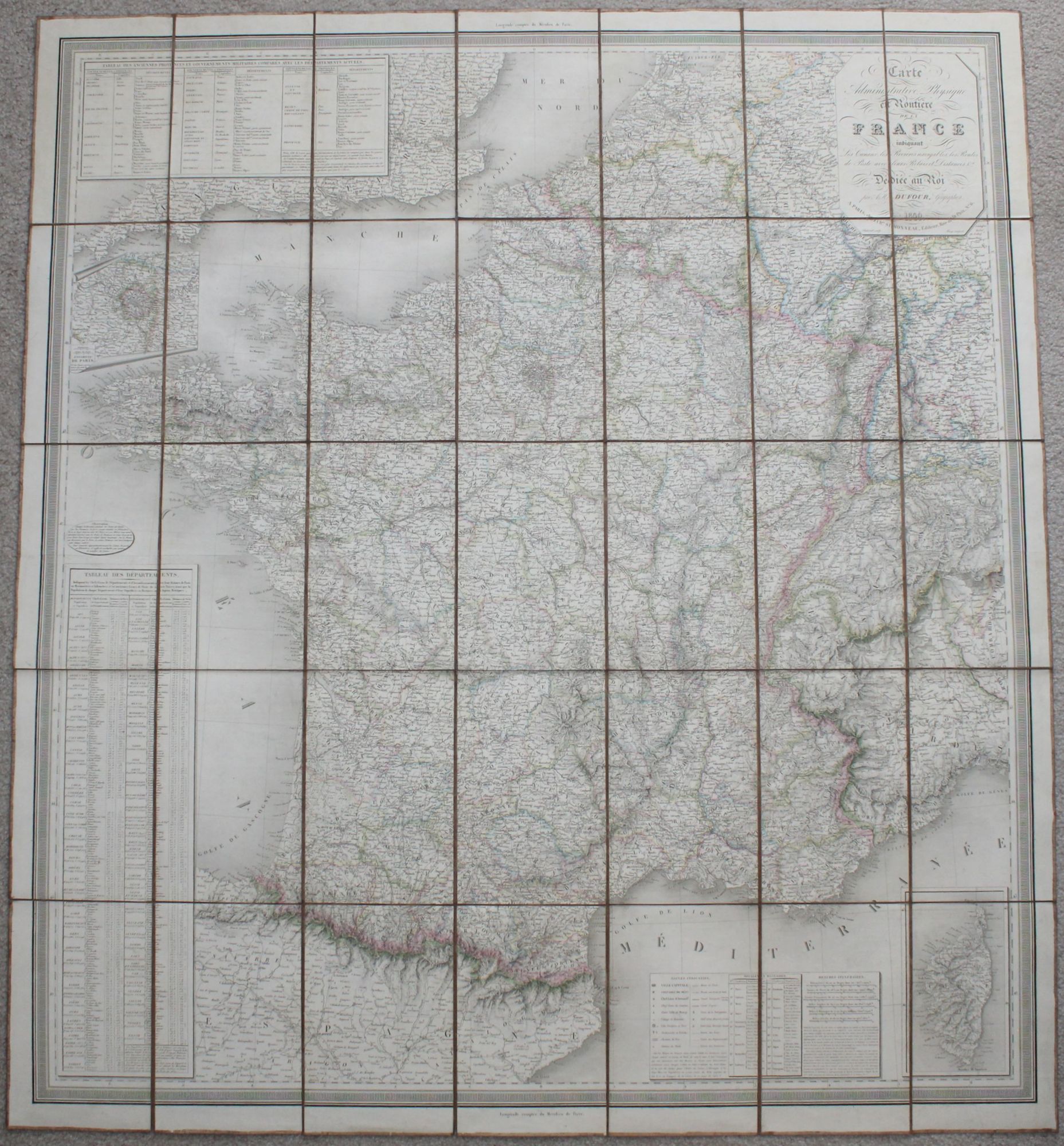
[Map] CARTE ADMINISTRATIVE, PHYSIQUE, ET ROUTIERE DE LA FRANCE
Paris: Charles Simonneau, 1840. Item #5475
43" x 39", 109cm x 99cm. Folding, linen-backed map as issued in marbled paper covered chemise with matching case. Case is missing two rails and the third is chipped; retains gold stamped label; chemise is worn. Both the chemise and the back of the map have Charles Simonneau's engraved label. Linen backing is discolored but seems in good condition and supple. Ownership note on the back of the map, under Simonneau's label identifies this as a gift from Francis Peyre Porcher (1825-1895) to his daughter Julia P. Wickham. Wickham's note, dated 1902, says Porcher picked the map up in Paris before 1850. Porcher was a physician and botanist from South Carolina. He was an enslaver and secessionist. He served as a surgeon for the Confederacy and is perhaps most known for his book, "Resources of the Southern Fields and Forests" (1863). A beautifully printed map of France with a most interesting association.
Price: $350.00